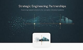

3D Laser Scanning – Digital twins as a reliable basis for modern planning
Why laser scanning has become essential
Retrofits, extensions, and modifications in industrial plants and existing buildings require a planning basis that goes far beyond conventional surveying.
Measurement errors in existing structures often lead to construction delays, additional costs, and improvised solutions—especially in complex, historically grown environments.
This is where 3D laser scanning becomes indispensable.
Using modern laser technology, existing conditions are captured completely and transformed into an accurate 1:1 digital twin. This digital representation forms the foundation for all subsequent planning, engineering, and execution processes.
Creating a precise point cloud
Using high-resolution FARO laser scanners, existing structures are captured with high density and accuracy.
Multiple scan positions—indoors and outdoors—are combined into a single, coherent point cloud, independent of:
- complex geometries
- limited accessibility
- varying lighting conditions
- extensive technical installations
The result is a faithful digital representation of walls, structures, installations, deviations, and surface irregularities.
CAD-based processing and digital planning
The point cloud is imported into our CAD systems and used as the digital basis for:
- reference modeling of structures, machinery, and plant components
- generation of precise 2D as-built drawings
- sections, elevations, and layout derivations
- collision detection for new installations
- dimensional checks and tolerance analysis
- export for BIM and further planning environments
In this way, the real-world environment becomes an integral part of the digital engineering process.
Efficient handling of large point clouds
To work efficiently with extensive datasets, we apply:
- clipping functions to isolate relevant areas
- region-based filtering to structure large data volumes
- freely defined section planes for targeted design work
- modular working areas for plant engineering, architecture, and interior planning
This enables efficient processing of even large industrial facilities without compromising performance or workflow stability.
BIM integration and digital project coordination
For larger projects, point clouds can be directly integrated into BIM workflows. Key benefits include:
- all disciplines working on a single, reliable data source
- seamless continuity from planning to operation
- early detection of geometric conflicts
- improved decision-making through full transparency
In international projects, the digital twin often serves as the central interface between distributed teams and disciplines.
Typical application areas
3D laser scanning is used in:
- industrial retrofit projects
- mechanical and plant engineering
- architecture and structural design
- existing buildings and halls
- modifications during ongoing operation
- complex measurement situations with high geometric requirements
Wherever accurate as-built data is critical, laser scanning provides a secure and reliable planning foundation.
Conclusion
Modern 3D laser scanning creates a precise digital basis for industry, plant engineering, and construction.
The digital twin reduces planning risks, accelerates decision-making, and enables efficient collaboration across all project participants—regardless of location.
This article demonstrates how we apply laser scanning in real industrial projects: from on-site data capture to BIM coordination and as-built modeling—providing transparent insight into our methodology and the tangible benefits of modern scanning technology.